Wildfire
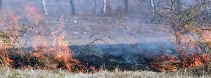
We finished a controlled burn in El Terreno’s vulnerable corner just in time. That afternoon a wildfire consumed all the fields on the east side of our road.
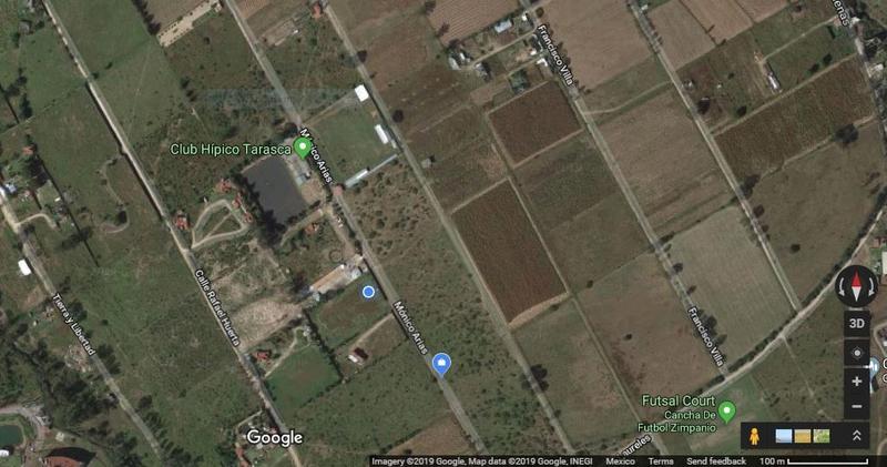
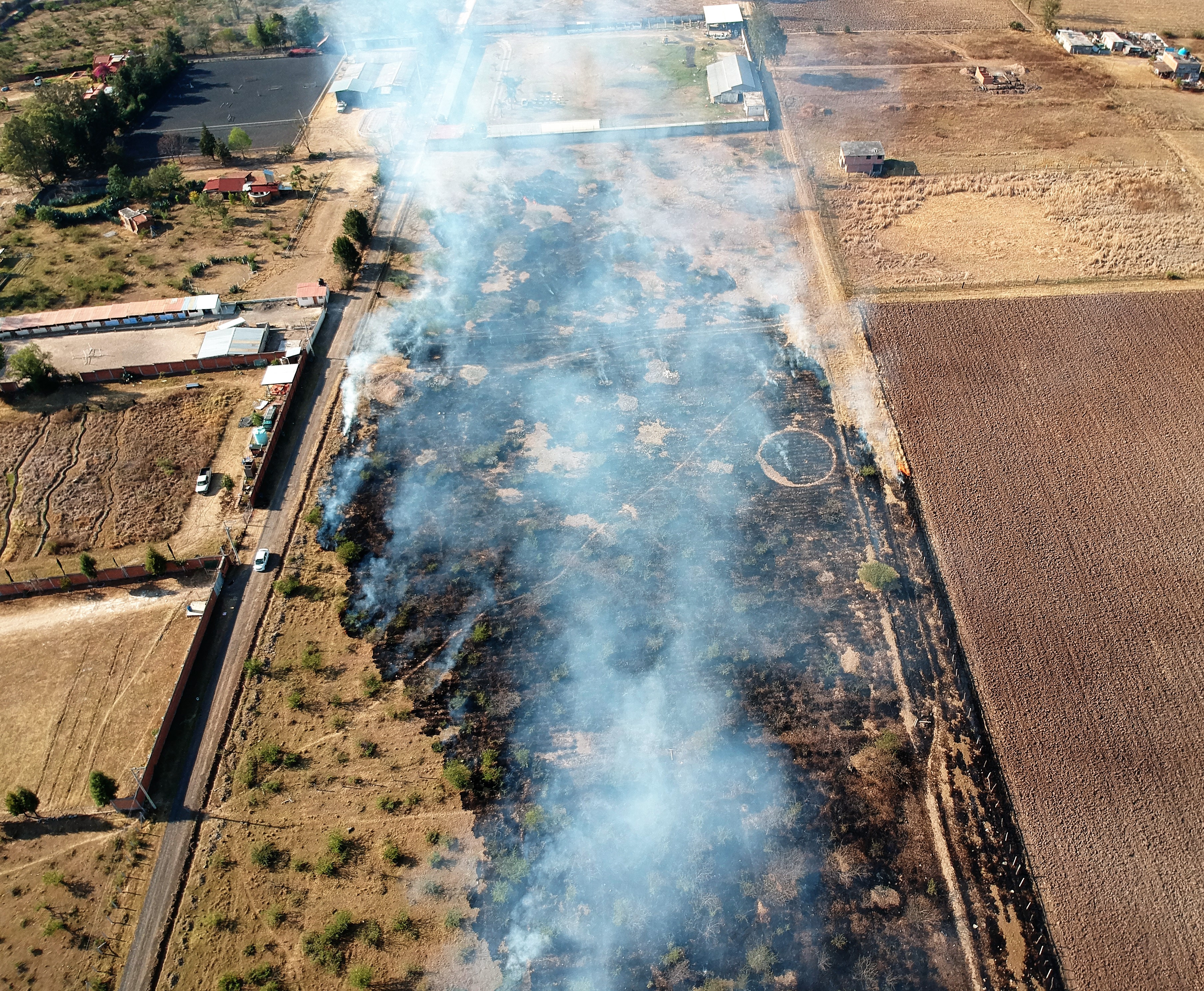
Compare before and after using google maps satellite view and Phillip’s drone footage.
Before: this photo must be from the winter before we arrived, because there’s no van, but our neighbors’ house is built - we live at the blue circle, between green marker and blue marker. Click the photo to go to google maps and move around, zoom, get your bearings.
Next it looked like this (you know, imagine them oriented the same). You can find us by the skyblue water tank on the left (might need to zoom in).
We explored the fire on foot and couldn’t find anyone - who set this fire? Did the fieldworkers leave their controlled burn and it spread? Yikes.
With the drone we realized that our friends’ home was in danger, so we headed down with a bucket of water and a wet mop. Turns out buckets of water were exactly what kept their home safe–they made a barrier, which worked (they have grazing animals keeping grasses low, so the barrier was sufficient). But it was scary and close, and the smoke bothered the kids, who waited in the car til it passed.
Mops were helpful, too - turns out that’s what the fire department uses! Huh?
Comments:
March 11, 2019
This was more of an adventure than I realized earlier from what I had looked at! I look forward to more details from you in person.